Remove GPS Location Data from Photos: Quick Answer
You can remove GPS location data from photos on iPhone in a few taps through the Share sheet Options menu. On Android you can strip GPS data using Google Photos or a third party EXIF editor app. Removing this hidden data does not affect any visible GPS stamp already printed on the image.
- Every photo taken on a smartphone may contain hidden GPS location data called EXIF metadata. This data records where the photo was taken even if no visible stamp appears on the image.
- You can remove GPS location data from photos before sharing them. On iPhone use the built in Photos app Share sheet. On Android use Google Photos or a file manager.
- Removing hidden location data is different from removing a visible GPS stamp. A visible stamp is burned into the image itself and cannot be removed without editing the photo.
- If you need location proof for work or records, use a visible GPS stamp app before removing EXIF data. The stamp stays on the image while hidden metadata disappears.
This guide focuses on removing hidden location data that is already saved in a photo. For the complete picture of how photo GPS and EXIF metadata works across both platforms, see our complete photo GPS metadata guide.
Why Photos Contain Hidden GPS Location Data
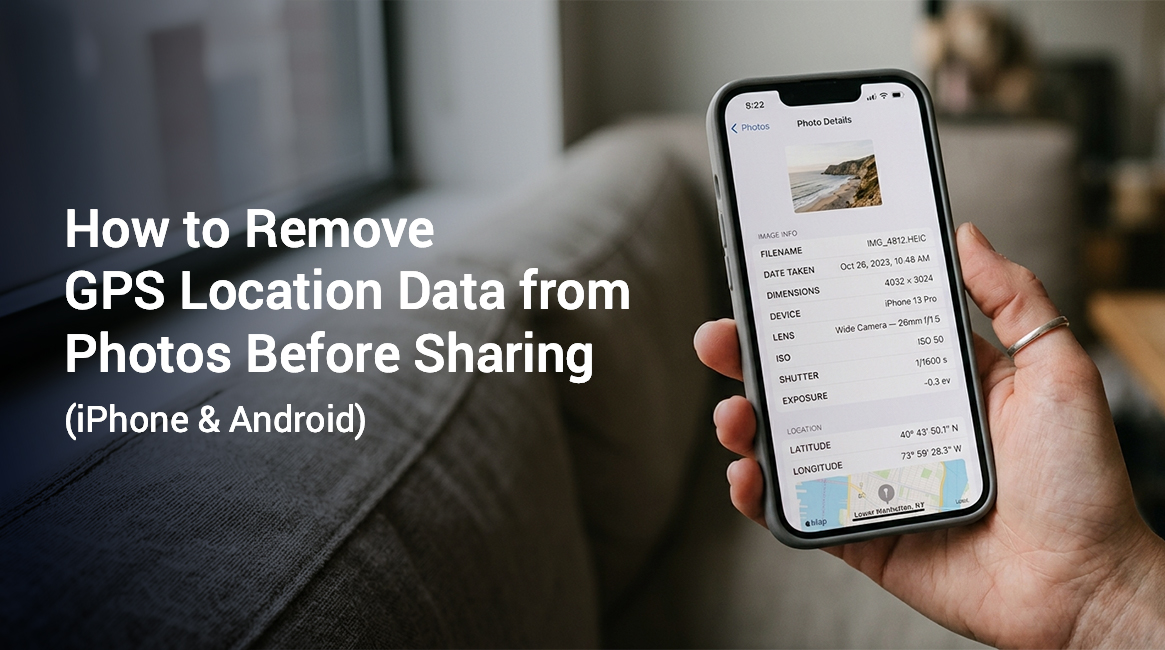
Every smartphone with location services enabled records GPS coordinates silently in the background. When you take a photo, the camera writes that location data into the image file as part of something called EXIF data (Exchangeable Image File Format).
EXIF is a standard for storing technical information inside a photo file. A typical photo can store several details inside this format:
- Camera model and manufacturer
- Date and time of capture
- Shutter speed and lens aperture
- GPS coordinates when location services are turned on
GPS coordinates are the latitude and longitude values that identify a precise point on the earth’s surface. These coordinates can be stored in degrees minutes and seconds. They can also be stored as decimal values. Anyone with access to the image file can open the EXIF data and see exactly where the photo was taken.
This process is called geotagging. Geotagging is the automatic tagging of a photo with its geographic location. Most smartphone cameras geotag photos by default when location access is granted to the camera app.
Most people never see this data. It travels silently with the photo file when you share it through email, messaging apps or social media. Some platforms strip this data automatically. Otherwise you need to remove it yourself.
What Information Is Stored in EXIF Location Data
A geotagged photo may contain:
- Latitude and longitude: the core GPS coordinates
- Altitude: how high above sea level the photo was taken
- GPS timestamp: the exact UTC time recorded by the GPS chip
- GPS direction: the compass direction the camera was pointing
- Map datum: the coordinate reference system the photo uses, typically WGS 84
This is separate from any visible stamp. A visible GPS stamp is the kind of location marker printed directly on the image by an app like GPS Map Camera. It becomes embedded in the pixels of the photo. It stays visible regardless of what happens to EXIF data.
How to Remove GPS Location Data from Photos on iPhone
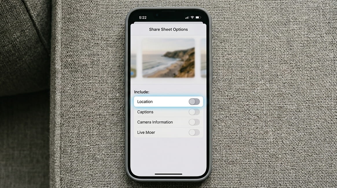
The easiest way to remove EXIF location on iPhone is through the built in Photos app. Apple added a native location stripping option in iOS 13, so no third party app is required for most tasks.
Method 1: Remove Location When Sharing (iOS 13 and Later)
This is the quickest option. It removes GPS data from the copy you’re about to share, without changing your original photo.
- Open the Photos app on your iPhone.
- Find and open the photo you want to share.
- Tap the Share button, the square icon with an arrow pointing up.
- At the top of the Share sheet, tap Options.
- Under the Location section, toggle Location off.
- Tap Done to return to the Share sheet.
- Choose how you want to share the photo. The copy you send will have no GPS data.
Your original photo in the Photos library keeps its location data. Only the shared copy has the location stripped.
Method 2: Remove Location from a Saved Photo Permanently
Use these steps to permanently remove location data from a photo already stored in your library.
- Open the Photos app.
- Open the photo.
- Swipe up on the photo to see its details.
- Tap Adjust next to the map thumbnail showing the photo’s location.
- Tap Remove Location and confirm.
This permanently deletes the GPS coordinates from that photo’s EXIF data on your device. The change syncs to iCloud if iCloud Photos is enabled.
Note: App features may vary by device and OS version. Check your iPhone’s iOS version to confirm these steps apply to your device.
How to Strip GPS Data from Photos on Android
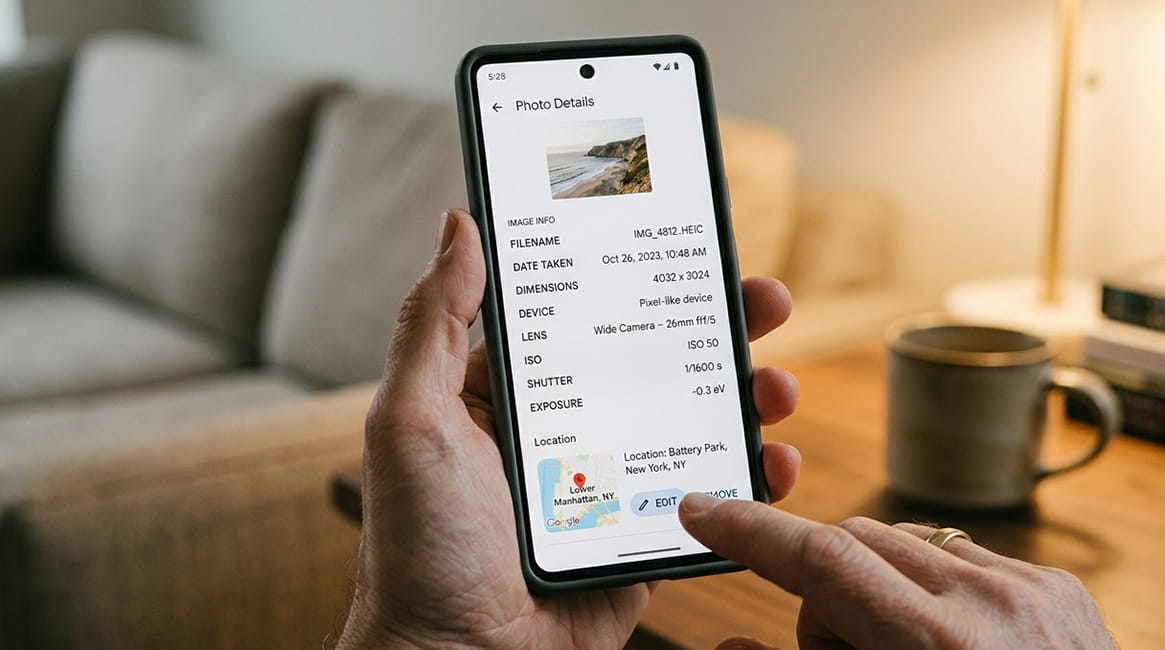
Android does not have a single universal method. The steps depend on the Android version, device brand and apps installed. Below are two reliable options.
Method 1: Remove Location Using Google Photos
Google Photos offers a built in option to remove location data from individual photos.
- Open Google Photos on your Android device.
- Open the photo you want to edit.
- Tap the three dot menu in the top right corner and select Info, or swipe up on the photo.
- Look for the Location section showing the map or address.
- Tap the pencil icon next to the location, or tap the map.
- Tap Remove location and confirm.
This removes the location from that photo in Google Photos. Keep in mind that edits in Google Photos may or may not update the original file, depending on your device settings and backup status.
Method 2: Use a Third Party EXIF Editor App
For full control over EXIF metadata, a dedicated EXIF editor gives you more options. Apps like Photo EXIF Editor, Exif Eraser and Metapho are available on both platforms and let you view and delete specific EXIF fields including GPS data.
Steps are similar across these apps.
- Open the EXIF editor app.
- Import or select the photo you want to clean.
- Find the GPS or Location section in the metadata list.
- Delete or clear the GPS fields.
- Save the edited copy.
Always save to a new copy if you want to keep the original intact.
Note: GPS accuracy may vary based on signal quality, device settings and nearby buildings. The coordinates stored in EXIF data reflect the phone’s location reading at the time of capture. This reading may not always match the exact physical location of the subject in the photo.
The Difference Between Removing EXIF Data and Removing a Visible Stamp
This is a point many people miss. There are two types of location information a photo can carry.
Hidden EXIF location data sits inside the file’s technical metadata. It is not visible when you look at the photo. It can be read by apps, websites and anyone with an EXIF viewer. Many platforms strip it on upload; others do not. The steps above remove this data.
A visible GPS stamp is text and graphics printed directly on the pixels of the image. This is what apps like GPS Map Camera produce. A typical stamp shows several details together:
- Street address
- GPS coordinates
- Date and time
- A small map
The stamp becomes part of the photo itself. It stays visible when the photo is viewed, printed or shared. This holds true no matter what happens to the EXIF data.
You cannot remove a visible GPS stamp by editing EXIF data. The stamp is part of the image itself. To remove a visible stamp, you would need to crop or edit the photo in an image editor.
This distinction matters for two opposite reasons. If you took photos with a GPS stamp app for work records, removing the EXIF data does not remove the visible proof. The stamp still stays on the image.
If you want to share a photo privately and worry about location exposure, check two things:
- Whether the photo has a visible stamp showing a location
- Whether EXIF GPS data is embedded in the file
For a deeper look at the technical difference between these two types of location data, see our guide on metadata vs visible GPS stamp.
When You Might Want to Remove GPS Location Data from Photos
There are several practical situations where removing location data before sharing makes sense. If you check your own photo library, you may be surprised how often this data gets attached automatically.
Sharing photos of your home. A photo taken inside or outside your house includes your home’s GPS coordinates in the EXIF data. Sharing this kind of photo publicly could expose your address. This applies to social media posts, online listings and forum threads.
Photos of children. Parents who share photos of children online often don’t realize they are also sharing the location of their home, school or regular activities through EXIF data.
Real estate and property photos. Agents and homeowners sometimes share property photos before a listing is finalized. Removing GPS data prevents early exposure of the address to unintended parties.
Travel photos shared during the trip. Sharing photos while you are still away from home can indicate to others that your property is unoccupied.
Business and field documentation. Some field reports contain sensitive site locations. Workers may need to share specific photos with one party without revealing coordinates to others.
Does Sharing on Social Media Remove GPS Data Automatically?
Most major platforms strip EXIF data when you upload a photo. This includes GPS coordinates. Platforms that do this include:
- Twitter/X
- TikTok
These platforms remove the data partly for privacy and partly to reduce file size.
However, this is not guaranteed across all platforms or all sharing methods. Some sharing methods may preserve the full EXIF data including GPS coordinates:
- Email attachments
- WhatsApp, depending on the setting
- Direct file transfers
- AirDrop
- Bluetooth sharing
- Cloud storage links
If privacy matters in a specific sharing context, it’s safer to remove the GPS data yourself before sending rather than relying on the receiving platform to do it.
Frequently Asked Questions
Yes. Some EXIF editor apps support batch editing, which lets you clear location data from several photos at once. On iPhone, you can select multiple photos in the Photos app and use the Share sheet Options to strip location data from all selected images before sharing.
No. A visible GPS stamp is printed directly onto the image pixels by a camera app. Editing or deleting EXIF data has no effect on it. To remove a visible stamp, you would need to edit or crop the image in a photo editor.
No. EXIF data is stored separately from the image pixels. Removing GPS coordinates or other EXIF fields does not change the visual quality of your photo. The image will look identical before and after.
On iPhone, open the photo in the Photos app and swipe up. A map thumbnail appears if GPS data is present. On Android, open the photo details in Google Photos or use an EXIF viewer app. On a computer, right click the file and check the Properties or Info panel for location data.
Yes, removing GPS metadata from your own photos is legal in most jurisdictions. It’s a standard privacy practice. Some exceptions apply for legal cases, insurance claims and official records. Check with a qualified legal professional before altering any file data in those situations. We do not provide legal advice.
GPS location data is a set of coordinates stored inside a photo’s EXIF metadata. EXIF stands for Exchangeable Image File Format. It records latitude, longitude and sometimes altitude at the time the photo was taken. This data is hidden from view, but anyone with an EXIF viewer can read it.
No. When you send a photo with no EXIF GPS data, it simply appears as a photo without embedded location. There is no indication that data was ever present or that it was removed. The photo looks and functions normally.
Keep Location Proof Where It Belongs: Visible on the Photo
Removing hidden GPS data makes sense for privacy. But certain situations still need clear location proof that travels with the photo and cannot be stripped away. This applies to situations such as:
- Field work and inspections
- Delivery confirmations
- Construction updates
- Property documentation
That’s where GPS Map Camera helps. Instead of relying on hidden metadata that can disappear when a file is shared or uploaded, GPS Map Camera stamps several details directly on the image itself:
- The exact street address
- Precise GPS coordinates
- The date and time of capture
- A small reference map
This information stays visible and permanent. Anyone who sees the photo can read it with no app or EXIF viewer needed.
Try GPS Map Camera on your iPhone or Android device. Start creating clear location verified photos for your work records, site visits and property reports.
Note: App feature availability may vary by device, OS version and location settings. Always check the latest app version for current features.