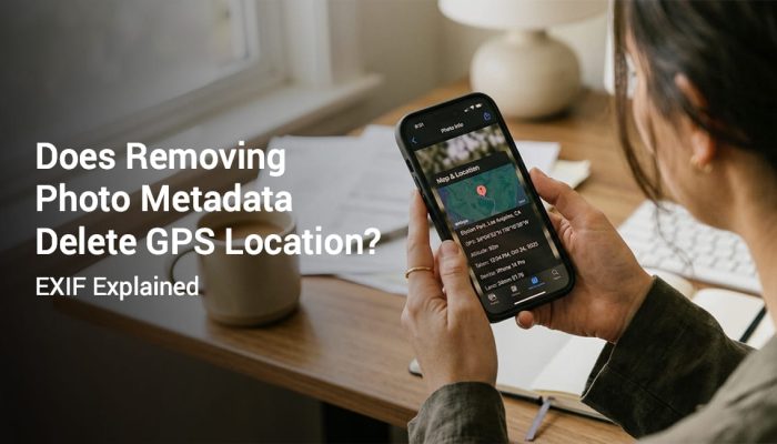
Many people want to know where a photo was taken after it has already been captured. This happens during work reporting, site inspection, delivery proof, travel planning, and personal record keeping. Sometimes the location is obvious. In many cases it is not.
A phone can store location data in different ways. Some photos contain hidden metadata. Other photos include a visible GPS stamp on the image itself. The easiest method depends on how the photo was captured and whether location services were enabled.
This guide explains how to know where a photo was taken using Android, iPhone, metadata, maps, and visible GPS stamp methods. It also explains when location data may be missing. You will learn which method is easiest for review and documentation.
Table of Contents
ToggleQuick Answer: How to Know Where a Photo Was Taken
You can find where a photo was taken in a few simple ways. The best method depends on whether the image has location metadata or a visible stamp. Some photos show the place directly on the image. Others require you to check file details or gallery map views.
- Check if the photo has a visible GPS stamp
- Open photo details on Android or iPhone
- Review map or location information in the gallery
- Check metadata if location was saved
- Use GPS camera apps for future photos
What It Means When a Photo Has Location Data
A photo with location data contains coordinates or a readable place reference connected to the image. This data may be stored inside the file as metadata. It may also appear directly on the image as a visible stamp. Both methods use device location information.
Metadata is hidden unless you open image details or use a compatible tool. A visible GPS stamp shows the location on the image itself. This makes review much easier for clients, inspectors, and supervisors.
Method 1. Check for a Visible GPS Stamp on the Photo
This is the fastest method. Open the photo and look for coordinates, address, map preview, or timestamp overlay. If the image was captured using a GPS camera app, the information may already be visible.
This method is best for proof of work and inspection reviews. It does not require file inspection tools. It also works well when photos are shared by chat or email.
If you want to understand this in more detail, read our guide on metadata vs visible GPS stamp. That article explains why visible location stamps are easier to verify.
Method 2. Check Photo Details on Android
On Android, open the image in the default Photos or Gallery app. Tap the details or info option. If location was saved during capture, you may see coordinates, address, or a map preview.
This method works only if location permission was enabled when the photo was taken. Some apps also remove metadata during editing or sharing. If nothing appears, the image may not contain location data anymore.
If you need help capturing future photos with visible location proof, read our Android GPS location and timestamp guide. It explains how to make location visible on the image itself.
Method 3. Check Photo Details on iPhone
On iPhone, open the image in the Photos app. Swipe up or tap the info button. If location was recorded, you may see a map and place information under the photo.
This works only if location services were enabled for the camera or app at the time of capture. If the photo was exported or edited, metadata may no longer be available. That is why visible stamps are often better for documentation.
If you want future images to show location directly on the image, read our iPhone GPS location and timestamp guide. It explains the full setup process.
Method 4. Use Metadata to Find the Location
Metadata is hidden information stored inside the image file. This may include capture time, device model, and GPS coordinates. The most common format is EXIF metadata.
If location metadata is present, you can inspect it through gallery details, desktop file info, or compatible apps. This method is useful when the image does not have a visible stamp. It is less convenient for quick review.
If you need a deeper explanation of hidden location data, read our guide on metadata vs visible GPS stamp on photos. It explains when metadata is useful and when it is not.
Method 5. Use Map or Search Clues from the Photo
If the image has no GPS metadata and no visible stamp, you can still estimate the location. Look for signs, business names, landmarks, roads, or building details in the image. Then compare those details in map apps.
This method is slower and less reliable. It can still help in travel or memory related situations. It is not ideal for professional proof or compliance reporting.
Why Some Photos Do Not Show Location
Location data may be missing for several reasons. The user may have disabled location services. The image may have been edited, compressed, or sent through a platform that removed metadata.
Some default camera apps save metadata but do not make it easy to review. In other cases the device never got a strong GPS signal. That means the photo was saved without useful location data.
Metadata vs Visible GPS Stamp
| Feature | Metadata | Visible GPS Stamp |
|---|---|---|
| Location visible on image | No | Yes |
| Needs extra review step | Yes | No |
| Easy for client or supervisor | No | Yes |
| Can be stripped during sharing | Yes | No |
| Better for proof workflows | No | Yes |
Which Method Is Best for Work Documentation
For work documentation, visible GPS stamps are usually the best option. Supervisors and clients can review them instantly. There is no need to inspect hidden metadata or open map tools.
This is especially useful for proof of work, field visits, and inspections. A visible location and timestamp can reduce disputes. It can also simplify reporting and review workflows.
If you use photos for documentation, read our photo proof of work guide. It explains how stamped photos support better verification.
How Accurate Is Photo Location Data
Photo location accuracy depends on signal strength, device quality, and surroundings. Open outdoor areas usually provide better results. Tall buildings and indoor spaces can weaken location precision.
If you want a full explanation of this, read our GPS photo stamp accuracy guide. It explains common errors and how to improve accuracy before capture.
Best Practices for Future Photos
- Enable precise location on the device
- Keep automatic date and time enabled
- Wait for GPS lock before capture
- Use a GPS camera app when proof matters
- Keep original files without editing
- Store records in organized folders
Who Should Use Visible Location Stamps
Field inspectors need fast location verification. Construction teams need clear daily proof. Delivery staff need simple proof of service. Freelancers need images clients can review quickly.
Government officers may also need location based documentation for public work. Travelers benefit when they want to remember exact places later. Visible stamps help whenever someone else needs to review the image.
Frequently Asked Questions
Yes. You can check metadata or gallery details if the location was saved. If the data is missing, you may need to use visual clues from the image. That method is less reliable than a visible stamp.
No. Photos only contain location metadata if location services were enabled and the app saved it. Some edited or shared images lose metadata. That is why not every image shows location.
Open the image in the default gallery or photo app and open the details view. If location data exists, you may see coordinates, address, or map preview. Shared images may not always keep this data.
Open the image in Photos and view the info section. If the image contains location data, you may see a map and place details. This works only if metadata is still present.
The easiest way is a visible GPS stamp on the image. It shows the information directly without extra tools. This is the simplest method for work documentation and quick verification.
Credibility and Update Notes
This guide is based on practical photo documentation workflows used in inspections, field work, travel records, and proof of work reporting. It is written for operational clarity. It is not legal advice.
Keep original image files when records matter. Review your device settings before capture. Use visible stamps when quick verification is important.
Use GPS Map Camera for Visible Photo Location
If you need a simple way to know where a photo was taken, visible GPS stamping is the easiest method. It helps with reviews, inspections, and record keeping. It also makes location data easier to understand than hidden metadata.